


Original price was: $13.99.$9.79Current price is: $9.79.
- Safe Transactions, Happy Customers
- Superior Quality Goods
- Sustainable materials, for a better tomorrow.
- Prompt service, every time.

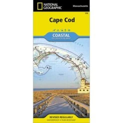
This Trails Illustrated topographic map is a comprehensive and complete recreational map for Massachusetts’ Cape Cod National Park. Let National Geographic’s® Cape Cod Coastal Recreation map lead you both on land and on water, along some of America’s most picturesque shorelines. Created in partnership with the National Park Service and others, the map provides unparalleled detail of the area.
The map includes valuable wilderness tips and Leave No Trace guidelines, along with updated trails, trailheads, points of interest, campgrounds, and much more. A full UTM grid is printed on the map to aid with GPS navigation. QR codes will allow you to conveniently connect to the U.S. Coast Guard Navigation Center as well as to check current weather conditions.
Printed on waterproof, tear-resistant material with a plastic coating for extreme durability.
- Approx. 4 1/4″ x 9 1/4″ folded
- Approx. 25 1/2″ x 37 3/4″ fully opened
- Scale = 1:63,360
- Includes Cape Cod Rail Trail
ISBN: 9781566953559
Be the first to review “National Geographic Cape Cod National Seashore Trails Illustrated Map”
Related products


Camp Stoves, Grills & Heaters

Camping & Travel


Camp Chairs, Cots & Tables

Air Mattresses & Pumps


Backyard & Camp


Camping & Travel

Camping & Travel


Camping & Travel
Reviews
There are no reviews yet.